
 Norsk
Norsk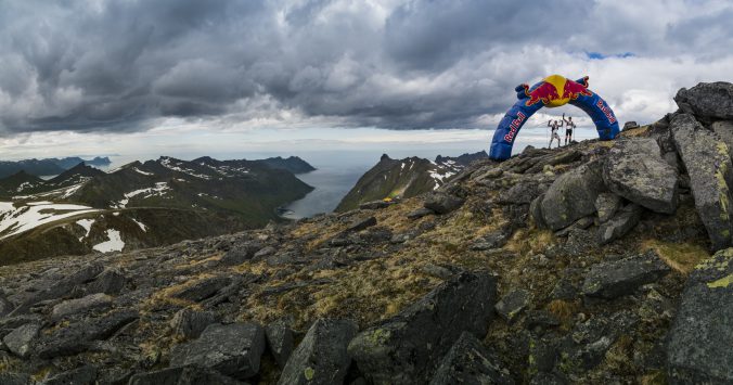
Having participated in the two latest editions of Xreid where we ran across the Hardangervidda plateau, I was pleased when the announcement came that this year the venue would be Senja. Norway’s second largest island with lots of raw terrain and plenty off peaks to climb. The route was planned at 122k with a total elevation off 5.500 meters. The predicted winning time was 15-hours in the press release and later adjusted to 18-20 hours. It turned out a little bit different…
The Xreid team has a philosophy to create a unique race experience each year with different routes and destinations, this makes it harder to plan and predict what to expect other than awesome views, tough climbs and great memories. The route this year on Senja had more elevation than previous years, less well used trails and more raw mountain terrain. Entry is granted by application where experience in similar type events and mountain skills are needed. Navigation is required but previous years the skills needed was minimal. Three checkpoint along the route with dropbags available, but still a quite extensive amount of mandatory gear, makes the pack heavier than in most races.
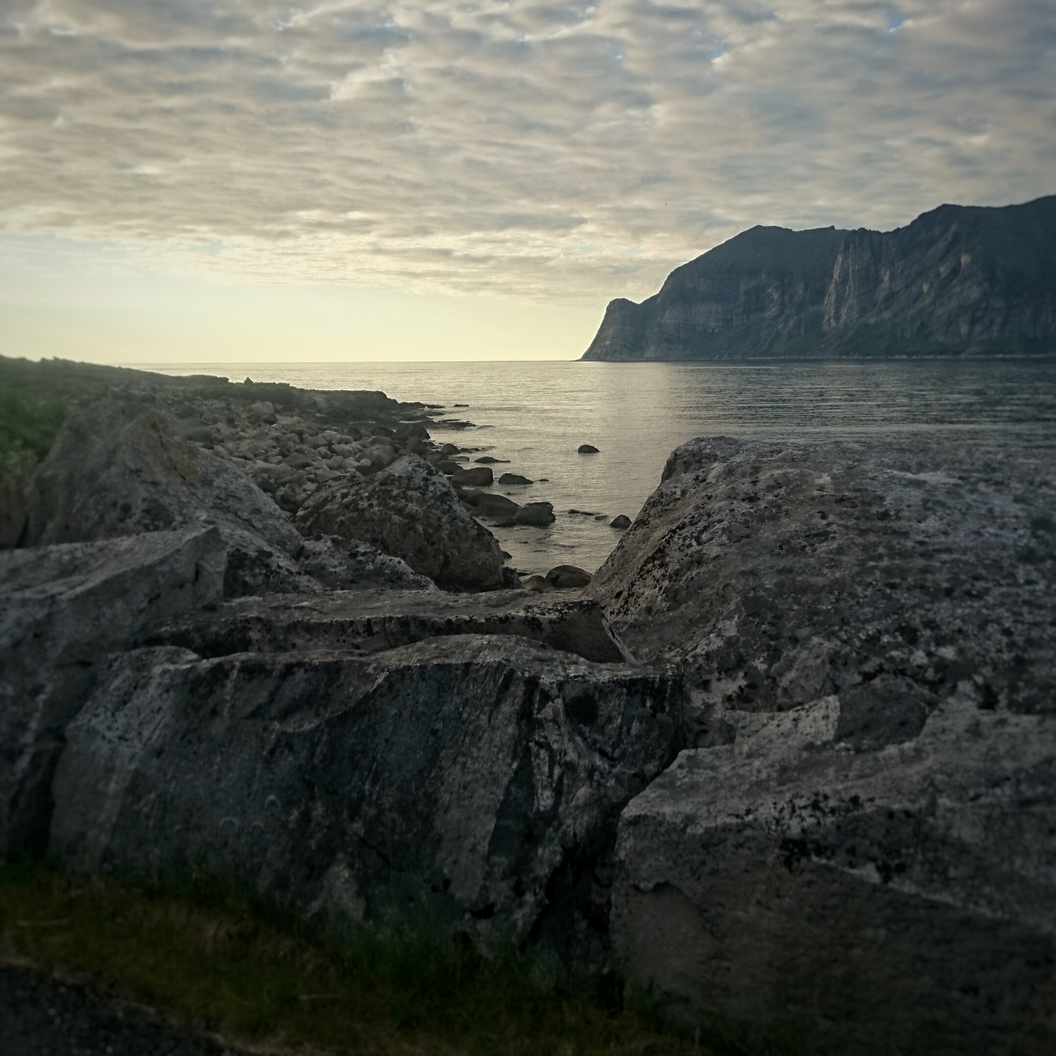
View from the pier at Mefjordvær
We arrived in Mefjordvær, the base and finish village just after 20:00 after a long day travelling. First a 4-hour plane ride to Tromsø, some hours waiting at the airport for the bus and then almost 4 hours by bus. I got a little peek at what was in store for us when we passed by areas where we hopefully would reach a day or two later. We had booked accommodation at Mefjord Brygge in an shared apartment with two other runners. I do appreciate staying close to the finish as it makes the logistics a lot easier when all you have to do is walk the few hundred meters to a shower and nice warm bed after finishing.
I had already packed all my gear ready and the check-in went quick. Liability-release signed, tracker handed out and picture taken in just a couple of minutes. There was no gear-check of mandatory equipment, but we where told there might be checks at the start the next day. One off the other participant who could not race on raceday (his brother was getting married) wanted to run the route and he ran alone starting a few days early. Reports were coming in that he was using a lot more time than expected, some off it caused by bad weather, but still an indication off what was in store.
After some chatting with the crew and participants, I had my self-prescribed (big) glass off red wine watching some football, before getting to bed early.
RACEDAY
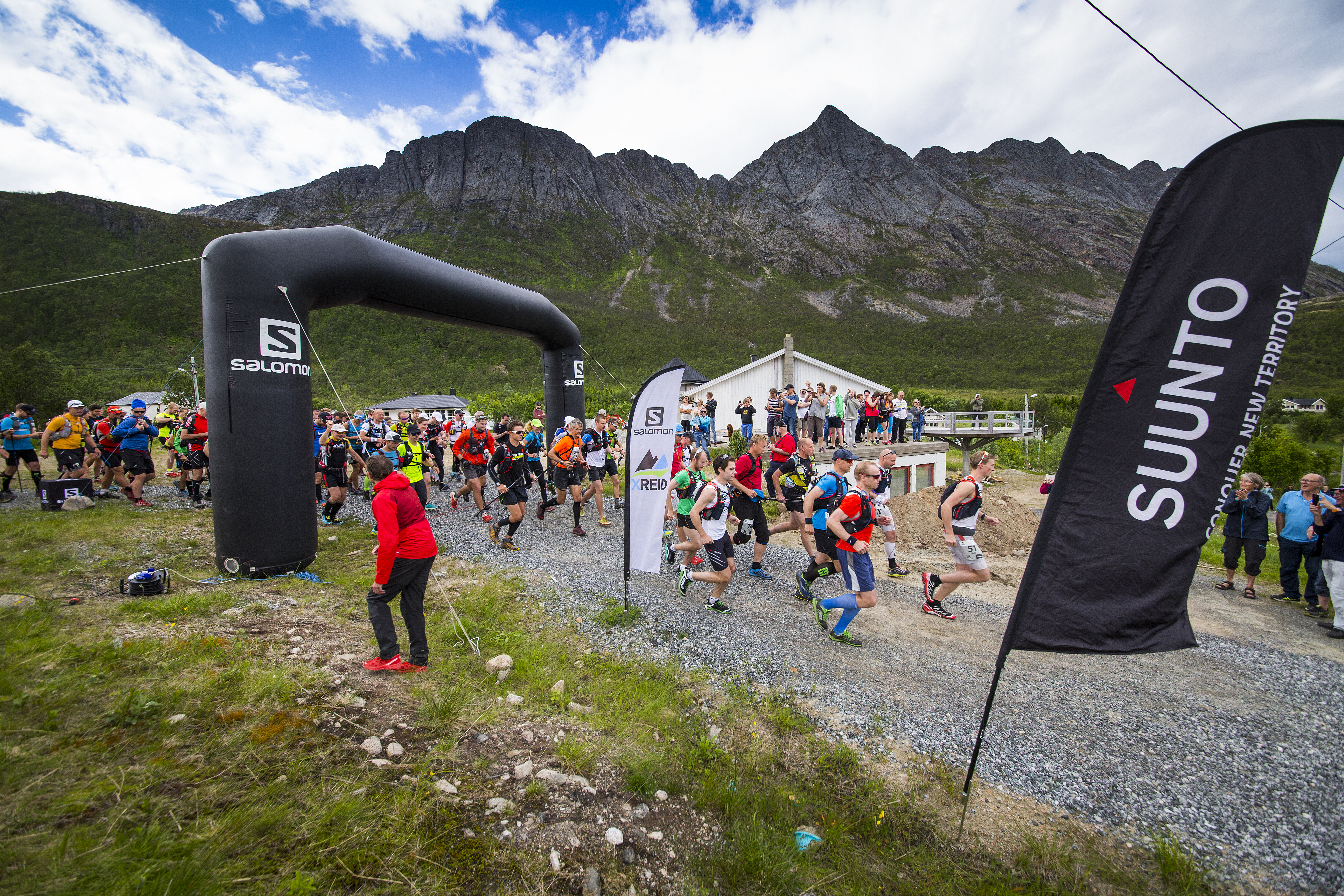
I woke up after a good night’s sleep and had a quick shower before eating my porridge. A quick last kit-check and we headed out to the bus who picked us up at around 08:00. The weather was as forecasted perfect, with partly clouded sky and around 18 degrees. Got to chat with Eero, a finnish guy who hosts a few races in Finland, and the suddenly the 2-hour bus ride went quite fast. We arrived at the small village (population 63) Rødsand where the start would be. There was a small festival that weekend, with a band playing for us while waiting and lots off people had turned up to see the crazy people who were crossing the island.
 Mats Grimsæth / Red Bull Content Pool
 The gun goes off in Rødsand
A short briefing before race start, where the important points being that the cutoff times were adjusted and that the last descent was changed due to safety. A few minutes before the 12-o-clock start we gathered behind the line and gave each other our best wishes on a safe trip. I lined up in the first line knowing I would fall back in the field on the 5k warm-up along the tarmac in the start.
START-CP1
The first part of the route followed the marked trail “Senja på langs” (Across Senja). We found out quickly that this was not a well used and maintained trail as the markings were sparse and the trail hard to see and follow. All participants are required to have a GPS and without it (or a map) we would never had managed. The terrain was extremely technical. Marches, bogs, rocks and creeks made the running hard and the pace slow. My clubmate and I had made a loose deal to keep together in the start. I wanted to start conservatively knowing I could use my legs later. One off my insoles rolled up and created a big lump under my heel and after a few stops to try and straighten it, I ended up just ripping the heel part of it completely off. My stomach got a bit noisy but a quick “pit” stop I felt great. I lost my mate temporarily when he cramped up jumping onto a wooden bridge, but a few kilometer later he caught up.
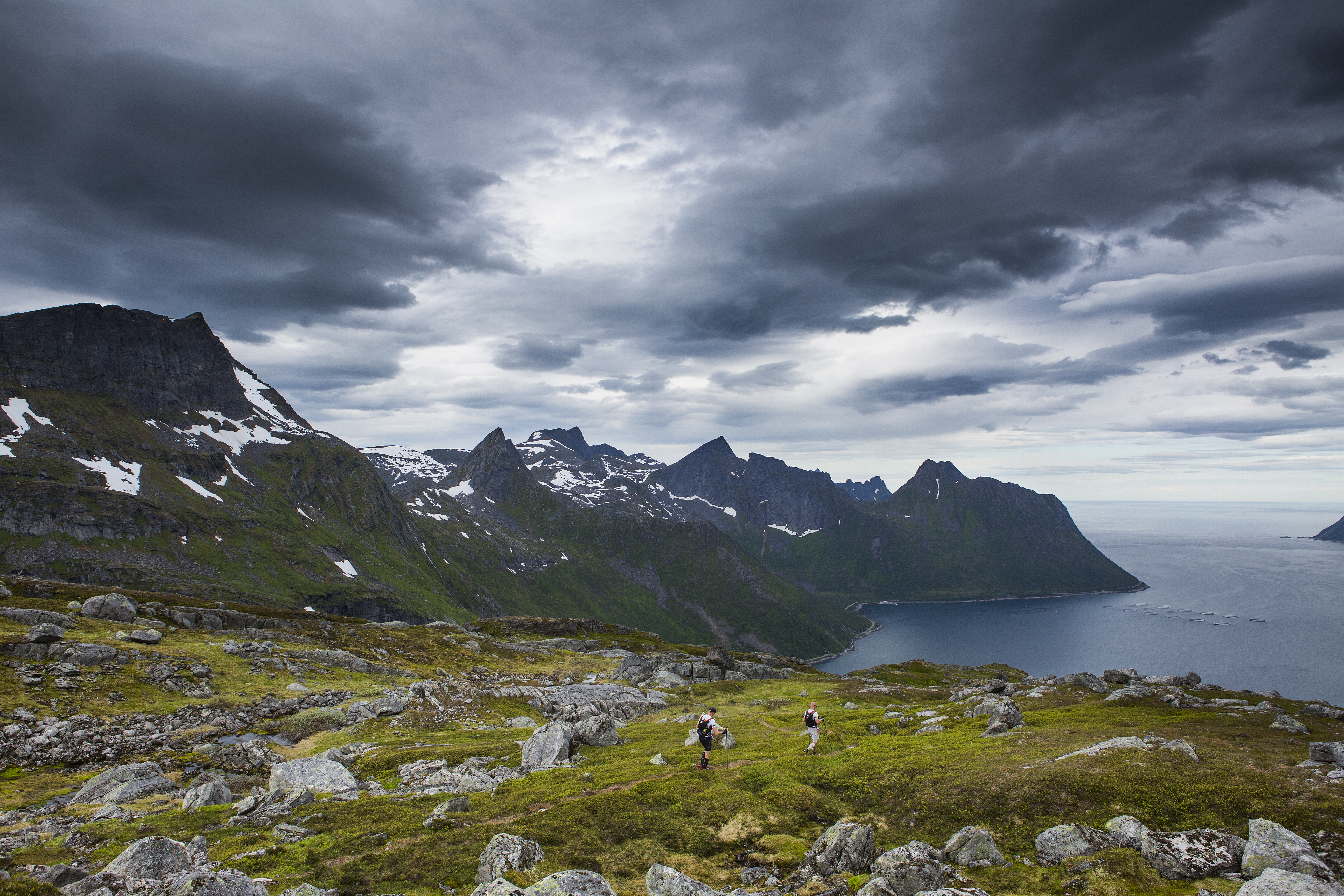
View from Kaperfjellet down to the checkpoint at the far end of the lake on the left side. The route followed the ridge on the right side.
Soon after we turned off the so-called marked trail and traversed along Kaperfjellet the last 10k to the first checkpoint at 45k. Rocky mountain terrain where broken occasionally by easy-running snowfields along the ridge. The checkpoint was in-sight but with the slow pace it took forever to get there. Just before the checkpoint there was a river crossing where I missed the rope they had put across it but was saved by some other runners who spotted it while I was fighting the ice-cold current trying to cross.
 Mats Grimsæth/Red Bull Content Pool
 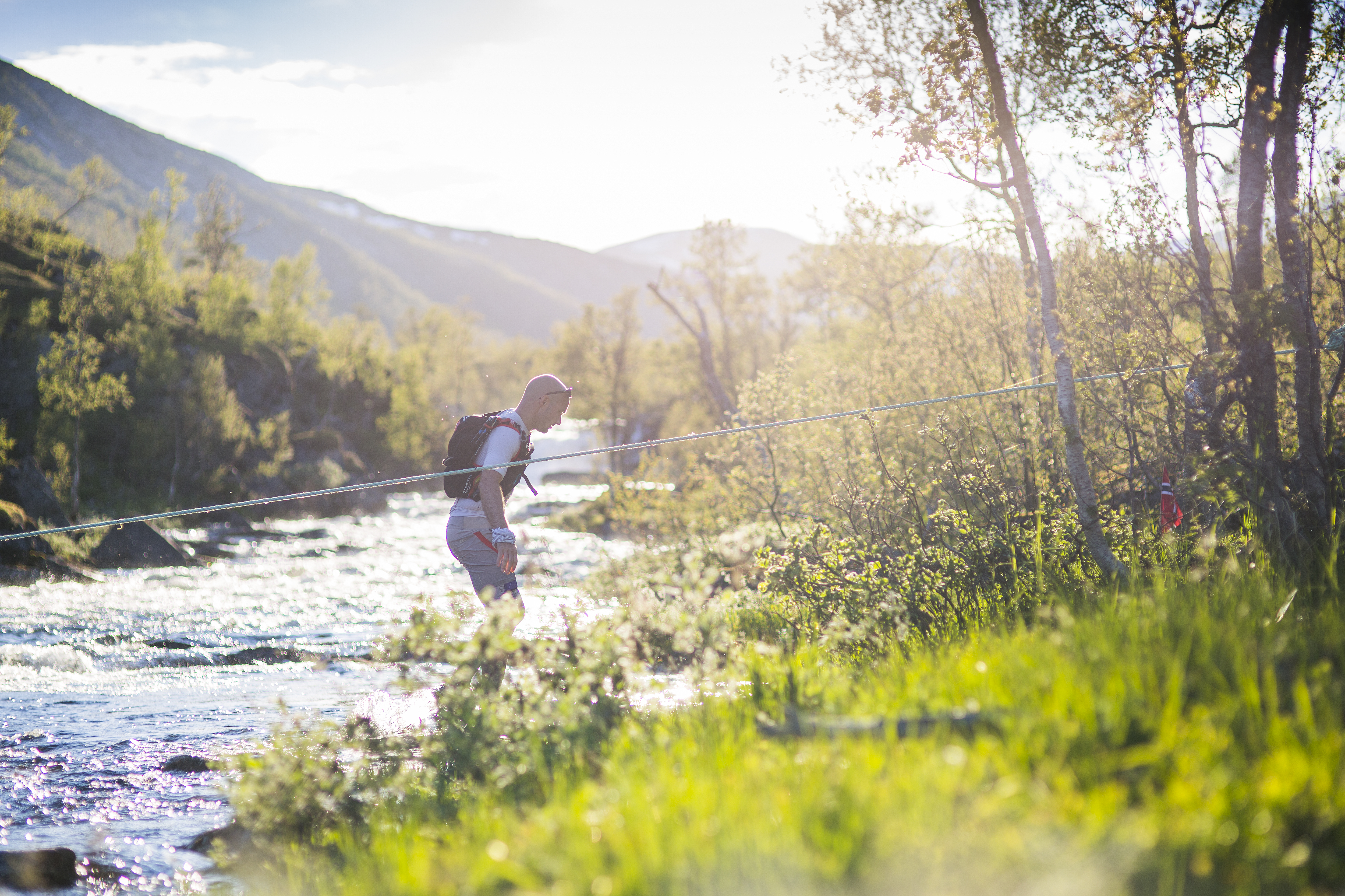 Mats Grimsæth/Red Bull Content Pool
Got over using the rope and headed up to the checkpoint. On the relatively easy leg according to the race manual (45k, 2000+) I reached the checkpoint after 8 hours and 45 minutes, not quite the 6 hours I planned a week earlier.
CP1-CP2
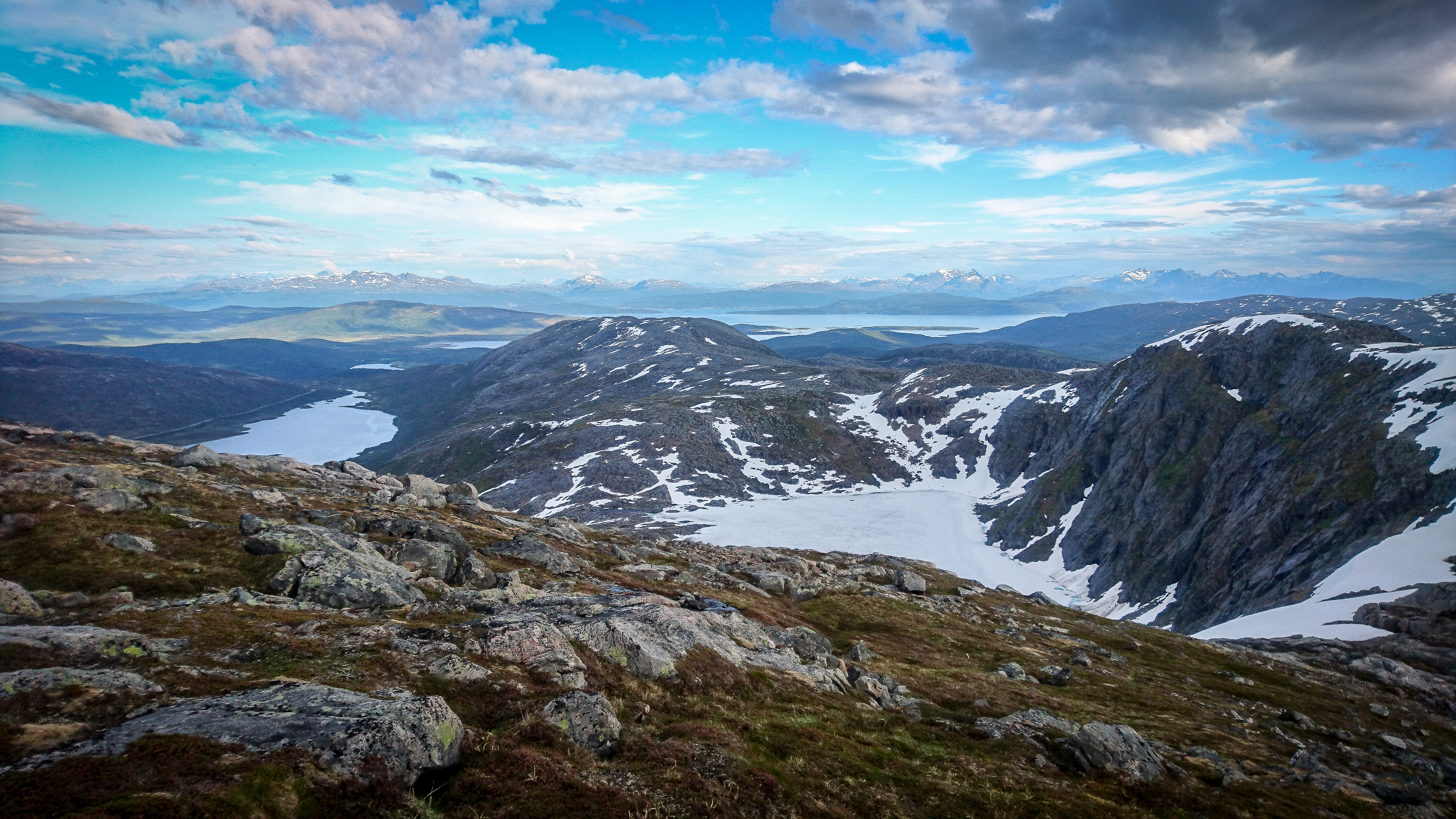
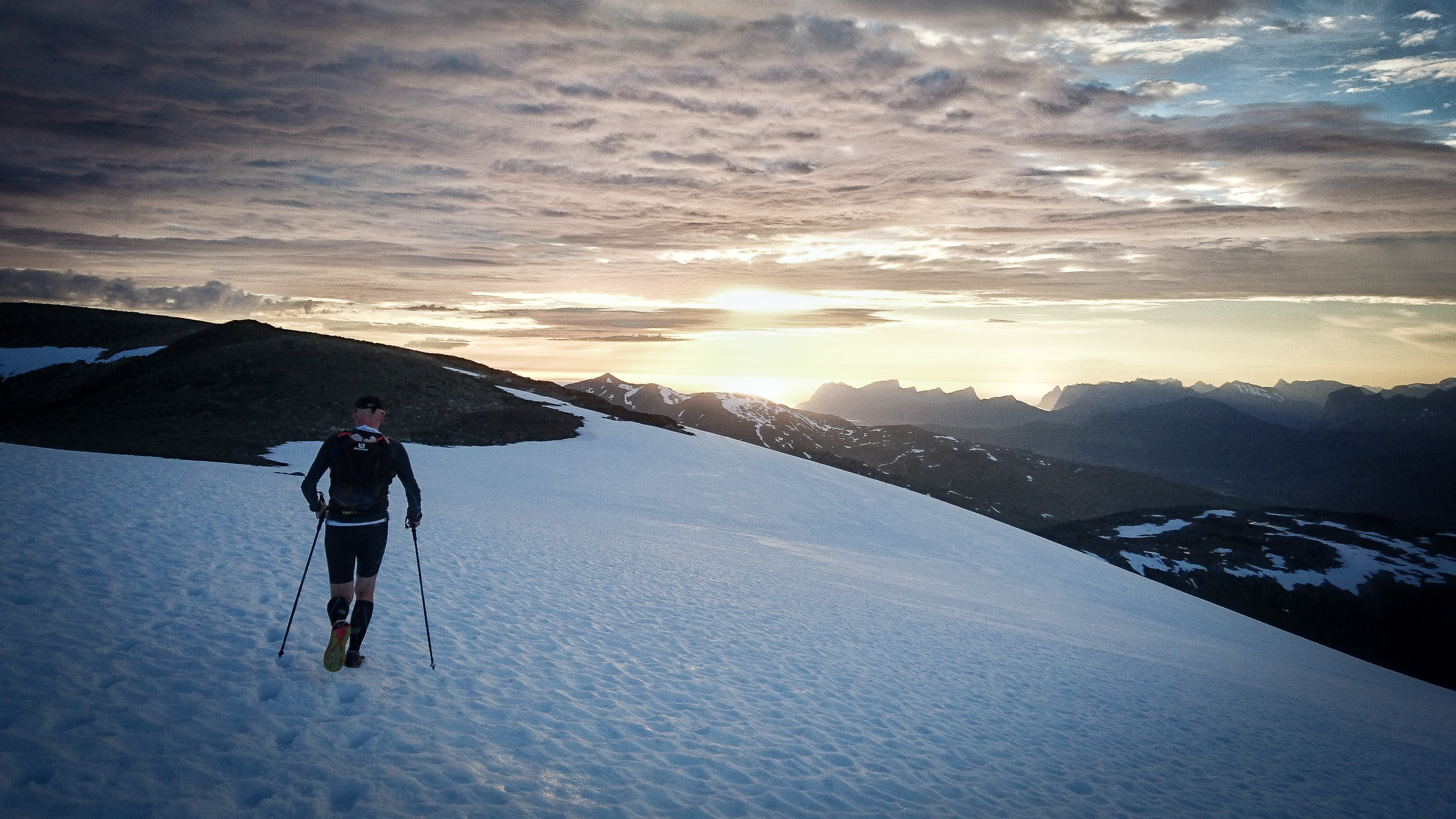
After a nice 10-minute stop while putting on a new shirt, a good dose of sunscreen on the head and restocking my pack while stuffing my face with the goods offered, I was ready to tackle the next big climb.  After a steep 600 meter climb we started on the 11k traverse over multiple peaks. Night was approaching and a cold wind made us stop and put on our wool tops. Rocky terrain meant we did not do much running but occasional snowfields made short “bursts” possible. In the middle of the traverse there was a short section with a narrow ridge with dropoffs on both sides. Nice to get the heartbeat up even though the pace was even slower. Not many creeks when following the ridge so my water supply was running short quite quickly.
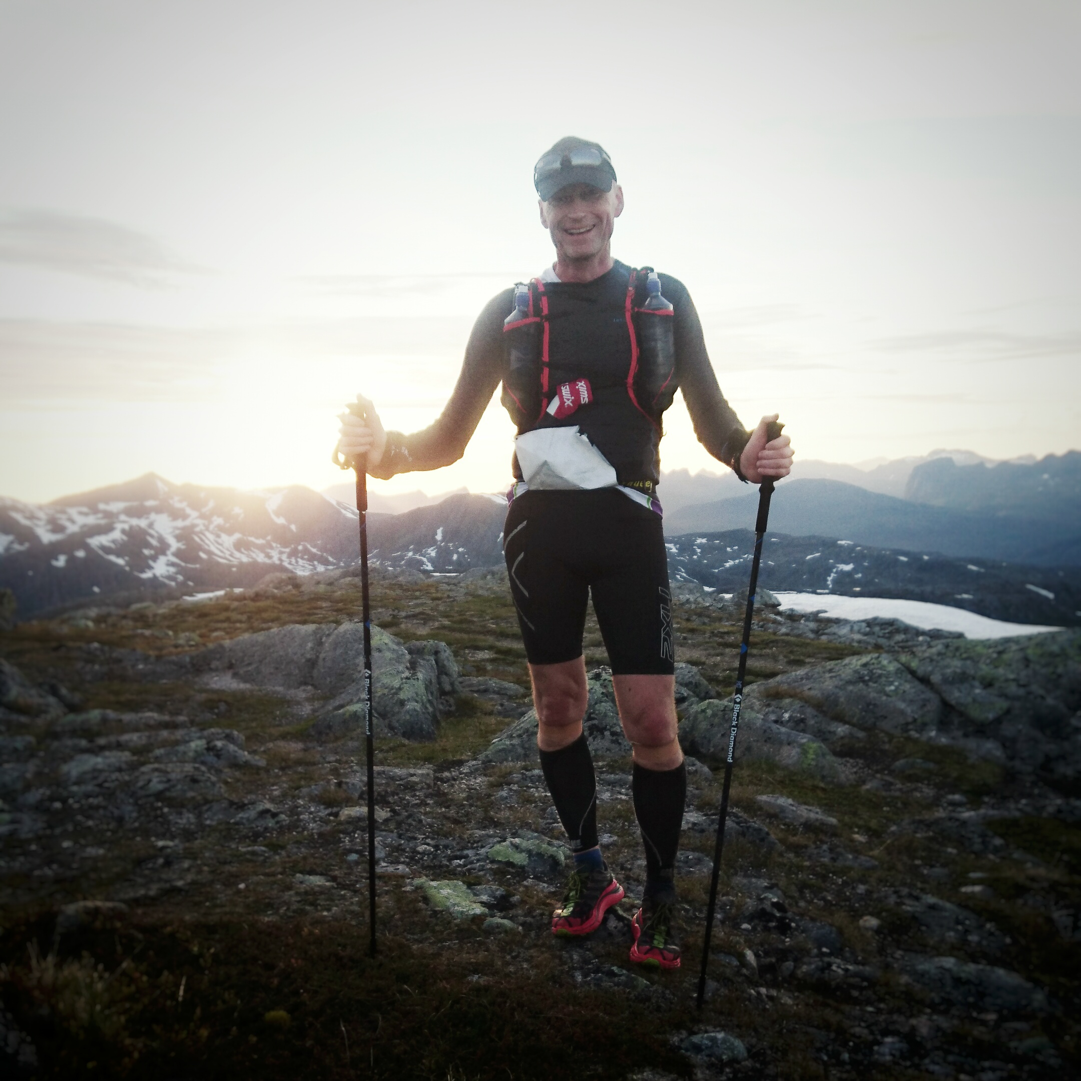
When midnight was approaching, Svein-Tore suddenly and surprisingly told me he was turning 50 in a few minutes. What a nice way to spend your anniversary, on top of a peak in the midnight sun with a 360 panorama view of the island. We stopped, I took a quick picture of him and as we descended down a snowfield laughing and I had to sang him a short verse of the birthday song.
When we finally got to the last peak (there always seemed to be one behind the one we just climbed) we started catching up to people who had taken off to hard in the start. My legs felt great and I had no issues so far so spirits were high when we reached the mental halfway point. We were now connecting to the marked trail which we left hours ago and this time there actually was one. We managed to run good stretches of the next 7 kilometers even though the trail was technical and boggy. At the 70k mark there was a short road section where the legs got to move for 5-minutes before we again where to follow a marked trail through Heggedalen (dal; valley) to the next 20k to the next checkpoint at Helvetesfoss (Hellfalls).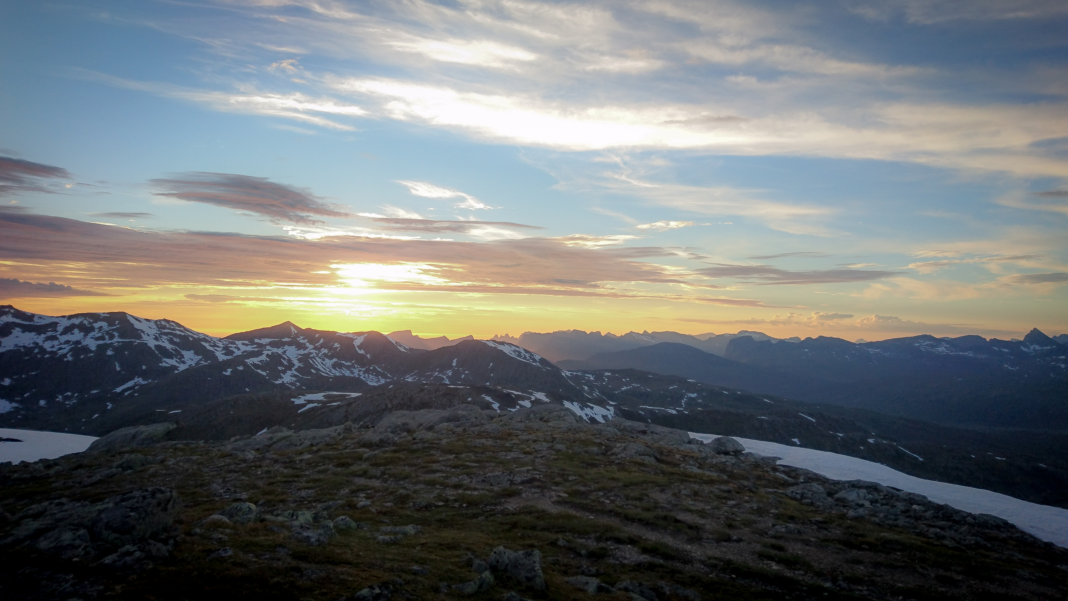
The trail was poorly marked in the beginning when we left the tarmac. I didn’t help that the track on our gps was 100 meters off. It lead us through mosquito infested fern for an hour before we with a little help from a fellow participant found the trail and could continue at walking pace. After a gentle but long climb through and up the valley we spotted the lake who meant the checkpoint was getting nearer. Our watches said we should be closer, but as almost always the plotted route on the map is shorter than actual distances.
The sun started rising again and the temperature as well as we plodded with a waking/running combination the last kilometers to the checkpoint. I refilled my pack with food and drinks while a quick oral medical check was conducted. Warm food at the checkpoint went down quickly together with warm coke and chips. The crew could also inform us that the planned 15k finish leg along the coast was cut. That meant that the finished leg now was on tarmac and a bit shorter. Our watches now showed 90k (should have been 84k) and we had been on our feet for nearly 18 hours.
CP2 – CP3
I had studied the last part quite good and knew what we had in store the 30k that remained. Legs were still feeling good and my food and fluid intake had been decent. We took off high on sugar the short climb that would take us to the plateau we were headed next. After a few kilometers on single-track we crossed a bridge and followed a nice pine-covered atv-track further up and into the valley. Crossed the same river again and left the trail for once again a steep climb and a long rocky traverse.
 Mats Grimsæth/Red Bull Content Pool
 At the end off the 10k traverse we came over this legs last peak and could almost see the finish line out in the fjord that stretched before us. The descent was painful and slow, quads and knees begging for short stops along the raw trail down the mountain. When we got down to sea level a short 1k road section would bring us to the last checkpoint. We were greeted by a big group of crew and went trough a more thorough medical check. We where informed that quite a few had quit here and that there was not many who were in front of us. The crew sang for Svein-Tore and after once again restocking and filling up with warm food, coke and chips we were ready for the last hard leg.
CP3 – FINISH
The leg started with a steep climb up under the powerlines, pathless with thick vegetation and marsh covered rocky ground. Slowly working out way up the 500 meter climb to the first plateau. What seemed like an easy short transport to the base of the the next climb turned out to be a scary traverse along a steep rocky hill. A lake 100 meters below would catch us if we slipped, but our now tired legs managed to navigate the small boulders. Cresting the corner almost an hour later opened up the view of the last peak Roalden (862 asl). A big steep snowfield in the start of the climb once again proved the poles valuable as it would have been hard not to slide as we made our way further up. The last few hundred meters of the climb was along a rocky ridge but somehow went quicker than expected and suddenly we found ourself a short walk to the last peak. A 300 meter vertical drop on one side and a big natural bowl on the other made the scene epic. A few photographers and crew were greeting us as we made our way to the Redbull arc and passed symbolically under it before giving ourself a pat on the back. The crew gave us directions on how to descend the new route down to the small village and the road waiting to bring us home at sea level.
 Kyle Meyr / Red Bull Content Pool
 The descend was slippy and steep but we made good progress the way down. We had already decided on walking in the last 6k to the finish, so we trotted along while cars passing by cheered. Our feet started burning not long after we hit the tarmac and we ironically missed the cold streams to cool our feet in. We eventually came around the bend that would reveal the finish and walked all but the last 50 meters to the finish.
 Mats Grimsæth/Red Bull Content Pool
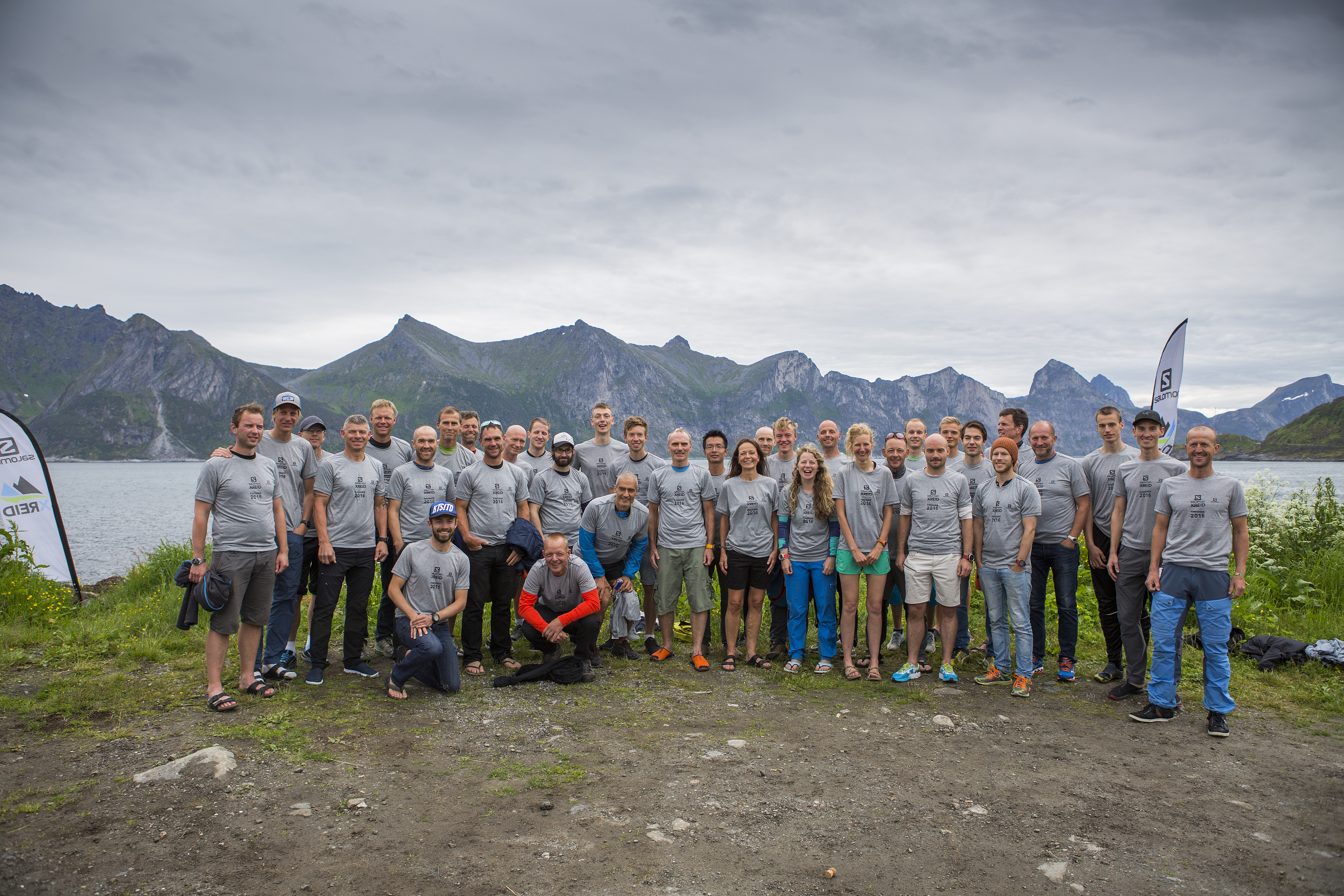
 Finishers of the 2017 Xreid Senja
We used a total of 26 hours and 56 minutes on the now 120k route with what turned out to be more than 6.000 meters of elevation placing 9th. Of the 120 participants that started only 48 made it to the finish.
LEARNING POINTS
Staying together in an event like this was very helpful. Navigation takes energy and being two or more makes it easier to notice when vearing of course. This was a mental race maybe more than physical. Everybody thought the trails would be better, less technical and more usable than they were and using a lot more time and energy than predicted makes your ability to tackle these changes crucial for completing.
LINKS
Strava activity – Strava flyby
Race webpage – Facebook – Media stream
GEAR
As planned my choice of using Hoka One One Speedgoats was perfect for the terrain. My feet were wet for 26 hours and even though I skipped a planned shoe and sock change I was blister free. The Salomon S-Lab 12 pack is also a nice piece of equipment on these kind of expeditions holding more than you thought and feeling secure all the way.
REQUIRED
Wind and waterproof jacket – Hagløfs Critus GORE-TEX jacket
Wind and waterproof pant – Peak Performance Swift pants
Whistle
Wool underwear (upper and lower) – Devold upper and lower
Windproof hat and gloves – GORE hat and gloves
Emergency blanket/ shelter
Grave light and matches (given by the organisers at registration)
Headlamp – Petzl e-lite
Credit card or cash
200 NOK in safety cash
GPS with lithium batteries – Garmin xTrex 30x
2 extra lithium batteries for the GPS
Compass
Fully charged cell phone (turned OFF, placed in backpack) – Sony Xperia 5 Compact
Basic first aid kit
MORE PICTURES
Leave a Reply